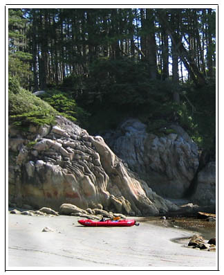
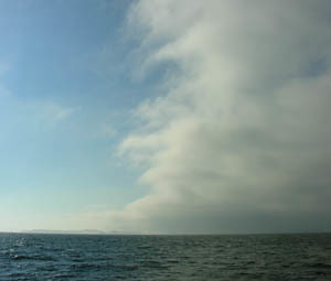
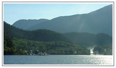
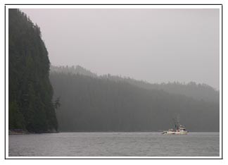
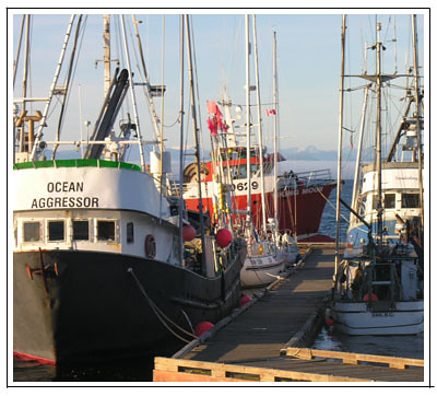
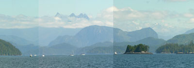
Friday, August 19, 2005

Johnstone Strait


Johnstone Strait, originally uploaded by macatay.

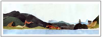
Sunday, August 15, Port Neville: Wind funnels through the Johnstone Strait, blowing up a gale every afternoon, so we sit at anchor in this protected spot waiting out the calm water of early morning.

Saturday, August 13, 2005

Alert Bay


Alert Bay, originally uploaded by macatay.

Alert Bay, BC: Indian town on the north end of Vancouver Island. A museum full of the masks and magic objects taken from the Kwakiutl after their last, illegal potlatch around 1920, and returned to them when the error of the white law was understood. Totems in the old burial ground include this one, which I think is the spirit Dzonq’wa, but also looks to me like a story teller.

The Kwakiutl stories as recorded by Franz Boas and other anthropologists are confusing to me – something about the rhythm of speech or the context is missing, and I don’t understand the meanings. And now the First Nations people in Alert Bay are talking into cell phones, although the older people still have the hushed, gentle speech patterns that make them seem as if they are murmuring into the phone, and I imagine that maybe they are telling the old stories.

Wednesday, August 10, 2005

Hakai Passage


Hakai Passage, originally uploaded by macatay.

Last year, we went north up the Inside Passage, the waterways that are protected from the open ocean. As we passed by the Hakai Passage, a big swell was rolling in from the Pacific, accompanied by fog. It seemed wild and mysterious, so we did some research. We found that the Hakai Passage area is a mecca for fishermen and kayakers, so this year we made a beeline to explore the area.

Moored safely in a protected bay, we found we could go ashore and hike the mile across to the Pacific beaches, and that a network of trails went on from there to more beaches to the north and south. We also discovered that we could launch our Michelin Man kayak out through the surf, and paddle to dozens more beaches and coves. This photo shows the red kayak in one of our secret coves.

We also discovered that paddling back in through the surf was more difficult, and we have yet to make a surf landing where we haven’t rolled out of the kayak and into the shallow water. This might be even more fun if the water were warm. But we couldn't possibly laugh any harder.

Hakai Beach Trails


Hakai Beach Trails, originally uploaded by macatay.

The trails that connect one beach to another along this coast are rough and tenuous, often skirting swampy muskeg and climbing over rocks. It’s constantly damp, and all the vegetation seems to be decaying as fast as it grows. We found this Creeping Dogwood (Cornus Canadensis) climbing up a cedar stump, with its roots acting like tendrils on a vine.

Tuesday, August 09, 2005

Blue and Gray


Blue and Gray, originally uploaded by macatay.

Tuesday, August 8,Port McNeill, BC: The weather here has settled into a summer pattern, with fog in the morning and brilliant, sunny afternoons. Often at midday, there is a line across the horizon which we have begun to call the Mason Dixon Line because it divides the blue sky from the foggy gray. These are just the same shade of blue and gray as the stripes on the big circus tents that were first manufactured just after the Civil War in a color scheme designed to appeal to Confederate and Union sympathizers equally.

There is no question in our minds – we greatly prefer the sunny blue skies!

Wednesday, August 03, 2005

Sun


Sun, originally uploaded by macatay.

August 3, Ocean Falls: The rain has stopped overnight – the total rainfall for the three days is about five inches. The sun is out. Wet jackets and rain pants, boots, fowl weather gear are hanging around the cockpit; wet towels and clothes dry on the lifelines. Hatches are open, condensation is wiped up, spirits rise.

We hike through odd, abandoned Ocean Falls, finding here and there buildings that are still used. There is an old hospital that is an inn, an old church where there is a restaurant. We catch hints that there is a greenhouse somewhere in town where a woman grows fresh produce. We are starved for fresh greens and produce, which reach stores here wilted and outdated, if at all, at the end of long trucking and barge journeys from the Vancouver area.

We hike all around, and finally find Audrey in her greenhouse, which is behind her house and in the midst of several other houses, now abandoned. She is remarkable, youthful but with long, straight gray hair. Her greenhouse is handsome, handbuilt and large, and all of her crops are in pots, since tests showed that the soil here was heavily contaminated by years of pollution from the paper mill. There are lettuces, lots of herbs, beans growing up the walls, and cucumbers hanging in pots from the ceiling. Her outdoor plants are in beds made by digging ditches between the rock outcrops, then lining them with plastic and filling them back up with soil. She generously shows us around greenhouse and garden, and sends us on our way with fresh salad greens, chard, herbs.

Can this be the same world as the one we occupied yesterday?

Rain


Rain, originally uploaded by macatay.

August 1, Ocean Falls, BC: It began to rain three days ago, when we were in Pruth Bay, only a mile or so from the open Pacific. Now we have sailed about forty miles inland, the entire journey in the rain, to Ocean Falls, which turns out to be the wettest place in Canada. It is also a ghost town, still the site of a dam and a hydroelectric plant, but once also of a pulp and paper mill. The population of 5000 has diminished to fewer than 100. Almost all of the buildings on shore are abandoned, including a 400 room hotel, disintegrating in this wet climate.

On this third day of rain, we are experiencing what the locals here call “hardy” rain. It varies from steady to downpour. I walk the mile along a shoreline road to the store, which is in a nearby valley. The road seems incredibly fragile, running along a ledge with cliffs above it, and steep rocks down to the inlet below. Water gushes down the cliffs in temporary falls, making clouds of spray that engulf me. I can see how often the road has been shored up and patched. I am in boots and rain gear, but wet through to the skin, and quite alone in my wet world. And in this world, everything is temporary and fluid and unimportant, disintegrating and dissolving slowly back into the ocean.

Down at Waterline


Down at Waterline, originally uploaded by macatay.

We have a two-man kayak, a very funny looking inflatable red boat that seems like the Michelin Man of kayaks. When we are anchored in a good, complex place, we blow up the kayak and paddle off to explore places no sailboat can go. We’ve even found some tidal rapids, where a narrow passage separates a lagoon from a broader bay, and been able to ride back eddies up and shoot the white water down again, albeit in Michelan Man style.

The best kayaking so far has been at low, low tide. Then we are right down at the very lowest waterline, eye level with lots of sea life that is usually underwater. Loads of star fish of every color and configuration. This odd sea anemone, which we think is a mottled anemone, was one of our favorite finds. Best of all is that we are on a level to see the spouts of water sent up from the clams in the mud flats – a sight that never fails to make us laugh like eleven-year olds.

Fishing


Fishing, originally uploaded by macatay.

Fury Cove, July 28: For as long as we have been sailing on Indigo, last summer and this, we have carried fishing tackle. Finally a sunny afternoon, with nothing much to do. Mac takes his tackle and goes off out of the anchorage in the dingy. Forty-five minutes later he is back with this beautiful salmon. He watched the water, saw a flock of sea birds in one place, motored over to that spot, and caught this fish on the first cast.

Public Docks


Public Docks, originally uploaded by macatay.

Port Hardy, 26 July: We are becoming less timid about tying up to the public docks in British Columbia. We were already happily settled for the night when the fishing fleet came back to the public docks in to Port Hardy. We are the small, white sailboat behind the Ocean Agressor in this photo. Although newly intimidated, we just stayed put on those public docks, because there was a spectacular sunset that demanded all our attention.

Road Map Scale


Road Map Scale, originally uploaded by macatay.

24 July, Wells Passage, BC: Always, there are the close-in shorelines, clothed in firs and cedars. Usually we can see to the surrounding hills rising up close to the shore. Occasionally, the clouds lift entirely and we can see back into the interior, past range after range of mountains, to the snow capped peaks and glaciers. Then we have to get out the road maps, because the nautical charts are too single in focus and small in scale to help us with this momentary glimpse of great distance.